-
About Homer
-
- Americans with Disabilities Act Compliance Program City Campgrounds Community Recreation Hickerson Memorial Cemetery
- Library Parks & Trails Public Safety Fire Police Emergency Information
- Events & Activities City Calendar Library Calendar Recreation Calendar Doing Business in Homer Sister City Program Coast Guard City
-
- Departments
- Government
- How Do I?
Flood Maps, Permits and Flood Protection Information
The Homer coastline contains mapped coastal flood hazard areas. Construction within these mapped areas requires a Flood Development Permit from the City. To find out if your property is in a flood zone, refer to the Flood Insurance Rate Maps linked below or contact the Planning Office. Staff can help determine if your proposed development is in the floodplain, and how the regulations may affect your project.
Flood Insurance Rate Maps
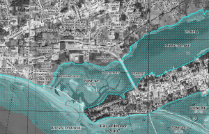
The following coastal flood hazard area maps are produced by the Federal Emergency Management Agency (FEMA) and are known as Flood Insurance Rate Maps (FIRM). These maps designate various levels of flood risk along Homer's coast. For example, the shoreline fronting Kachemak Bay is noted as a Velocity (V) flood zone, with base flood elevations (E) determined. These (VE) zones are subject to wave action in addition to rising flood waters. Some zones, such as the shoreline fronting Beluga Lake, zone AE (18), are not subject to wave action, but still pose significant flood risk. Knowing the risks, based on the floodplain designations, helps you build and protect your property responsibly. All of the current mapping is available at the links below, as well as at the Planning Office. Maps are listed west to east through the community with Spit maps listed last.
- Top of Baycrest Flood Hazard Map
- West Hill Area Flood Hazard Map
- Beluga Slough Flood Hazard Map
- Kachemak Drive/ Base of Spit Flood Hazard Map
- Kachemak Drive/East End Road Flood Hazard Map
- Middle of Spit Flood Hazard Map
- Middle of Spit (2) Flood Hazard Map
- End of Spit Flood Hazard Map
National Flood Insurance Program
Most homeowners insurance policies exclude flood coverage. Homer is a National Flood Insurance Program (NFIP) community so flood insurance is available through the federally backed flood insurance program. Insurance is available for structures and the contents, for renters and condo units, in or out of the mapped floodplain.
- FEMA Flood Smart website
- National Flood Insurance Program
- Myths and Facts About the National Flood Insurance Program
- Answers to Questions about the National Flood Insurance Program
Emergency Preparedness
Evacuating the Homer Spit can be a very real scenario during an emergency. More information can be found on the Emergency Preparedness and the Tsunami Danger Zones and Evacuation Routes webpages. Predicted flood areas are described and mapped in the State of Alaska Department of Natural Resources Tsunami Study.
- Coastal Erosion Map with Emergency Shelter Locations
- Updated Tsunami Inundation Maps for Homer and Seldovia, Alaska
Resources, Guides and Suggested Readings
- Anchor Fuel Tanks. An unanchored fuel tank can be moved by flood waters, posing serious threats not only to you, others, and your property, but also to public safety and the environment.
- Install Sewer Backflow Valves. In some flood prone areas, flooding can cause sewage from sanitary sewer lines to back up through drain pipes. These backups not only cause damage that is difficult to repair but also create health hazards.
- Raising Electrical System Components. Electrical system components, including service panels (fuse and circuit breaker boxes), meters, switches, and outlets, are easily damaged by flood water. If they are inundated for even short periods, they will probably have to be replaced.
- Drainage Improvements. Every community has a drainage system, either natural or human-made or, more likely, a combination of both. The drainage system carries surface water from where it falls (or where the snow melts) through channels to a receiving body of water.
- Dry Floodproof Your Building. One way to protect a structure and its contents from flood damage is to seal the building so that flood waters cannot enter.
- “On the Coast: A Guide Promoting an Understanding of Coastal Processes and Good Stewardship of Coastal Property on the Kenai Peninsula”, by Orson P. Smith is available at the Homer Public Library 551.457(AKA) SMI.
- Coastal Construction Manual: Principles and Practices of Planning, Siting, Designing, Constructing, and Maintaining Residential Buildings in Coastal Areas (2011) provides information about hazard identification, siting decisions, regulatory requirements, economic implications and risk management.
- Homeowner's Guide to Retrofitting: Six Ways to Protect Your Homer from Flooding


