-
About Homer
-
- Americans with Disabilities Act Compliance Program City CampgroundsCommunity Recreation COVID-19 Hickerson Memorial Cemetery
- Library Parks & Trails Public Safety Fire Police Emergency Information
- Events & Activities City Calendar Library Calendar Recreation Calendar Doing Business in Homer Sister City Program Coast Guard City
-
- Departments
-
Government
-
- Office of the Mayor City Council City Clerk's Office Committees & Task Forces
- Commissions & Boards ADA Advisory Board Economic Development Advisory Commission Library Advisory Board Parks, Art, Recreation & Culture Advisory Commission Planning Commission Port & Harbor Advisory Commission
- Homer City Code Public Meetings Agendas & Minutes Invitations to Bid & RFPs
-
- How Do I?
Coastal Erosion
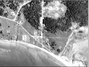
In 2004, the City contracted with the Kachemak Bay Research Reserve (KBRR) to conduct a coastal erosion study. KBRR acquired historical aerial photos, and drew a line at the top of the bluff for each photograph set. Then, the researchers calculated the average rate of erosion for each part of the Homer shoreline. You can view these photographs at City Hall in the Planning Department. We can also email you a map of a specific property.
The study did not look at what is causing the erosion, nor at ways to slow it down. The researchers did find that since 1975, the rate of erosion seems to be slower. Before, during and after the 1964 earthquake, erosion was faster. So the researchers extrapolated how much erosion could happen over the next 50 years, based on the 1975-current erosion rate, and the overall known erosion rate from 1951.
Maps: Contact the Planning Department at 907-235-3106. 48 hours notice is appreciated. Lot specific maps can be emailed!
Permits
Call the Planning Department at 907-235-3106 for more information on permit requirements for bank stabilization projects.
Resources
The City encourages neighbors to work together to solve erosion problems and to help each other during the permit process.
Kachemak Bay is a Critical Habitat Area below 17.4 feet. You may need additional permits or approval to operate equipment within this area. Agencies you may need to speak with:
- U.S. Army Corps of Engineers, Soldotna office: 907-753-2689
- State of Alaska Department of Fish and Game, Homer office: 907-235-8191
- Kenai Peninsula Borough River Center, Homer Annex: 907-224-2001


